
Google Earth is so new it that has not had much of a chance to be used as a prospecting tool, but it is just like flying around in an airplane only much less expensive. other forms of satellite imagery and aerial photographs have been used for years for a prospecting for valuable mineral deposits. With Google Earth it is possible to see the lay of the land without ever going to the site, so you can plan a prospecting trip before you ever get there. What is especially good about the program is that you can see places where gold and other valuable minerals are apt to be hiding.
The first thing you notice about Google Earth is that all the photos are vertical just like those used in geological mapping. You can also change Google Earth images so they are displayed as oblique photographs; for many people not used to vertical photographs the oblique photographs are more natural,and are easier to understand.
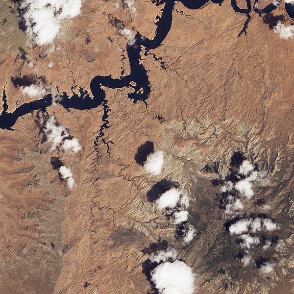 |
| Natural Bridge area in Utah. Note the lineations depicted in this picture as well as the watercourses that are possible indications of a fault. |
The next things you will notice if you look for are the number of lineations that can be seen in a Google Earth image. These are important because they often outlined a fault in the Earth's surface. Faults are often the home of valuable mineral deposits that have been deposited by hydrothermal activity.
Another place where Google Earth comes in handy is mapping the watercourses of streams and rivers. It should be remembered that streams and rivers often follow the line of least resistance this is usually a fault or contact between differing rock types. We can interpret these as zones of weakness that are apt to contain mineral deposits.
Another place where mineral deposits may be found is in areas with sudden changes in vegetation. One example is most sand & gravel deposits are under growths of white pines. In other places changes from deciduous trees might indicate an area is shallow to bedrock. The presence of certain species of trees like oak that have a long taproot indicate the soil is deep and a long way from bedrock. In deserts the presence of vegetation is often an indicator of water courses.
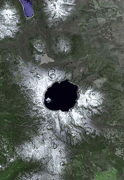 |
| Satellite view of Crater Lake, Oregon USGS |
Another feature that is readily seen on these images is the location of already existing mines. There is an old saying among Canadian prospectors that the best place to prospect for a mineral deposit is under the shadow of the head frame of an existing mine.
By looking at stream courses in a given area it is actually possible to pick up many of the places where placer deposits may exist in the inside bends of streams, or in former stream channels that are often visible on a satellite image.
 |
| Monteregian Hills, Quebec noted for rare minerals caused by magma intrusions from a traveling hotspot. |
One of the neat things about Google Earth is a read out at the bottom of the display the geographic coordinates in degrees, minutes and seconds making it possible to transfer those readings to a GPS unit so you can find your way on the ground to areas you saw on Google Earth,
Nice post! This is a very nice blog that I will definitively come back to more times this year! Thanks for informative post. underground mining definition
ReplyDelete